Commuter

Save on transit fares.

Quick Tips

  • Buy Transit Passes

    Set up an account at CommuterDirect.com to place renewable orders and automatically receive the tickets and passes you need for your commute.

  • Get a Guaranteed Ride Home

    Become a Commuter Connections user to access six FREE rides each year in the event of an emergency or unscheduled overtime.

  • Try Telework

    Join the 255,000+ DC-area employees that telework on a daily basis to help reduce the region’s traffic and emissions.

  • Buy a SmarTrip® Card

    Purchase a WMATA SmarTrip® card to be used interchangeably throughout Washington, Baltimore and the surrounding region.

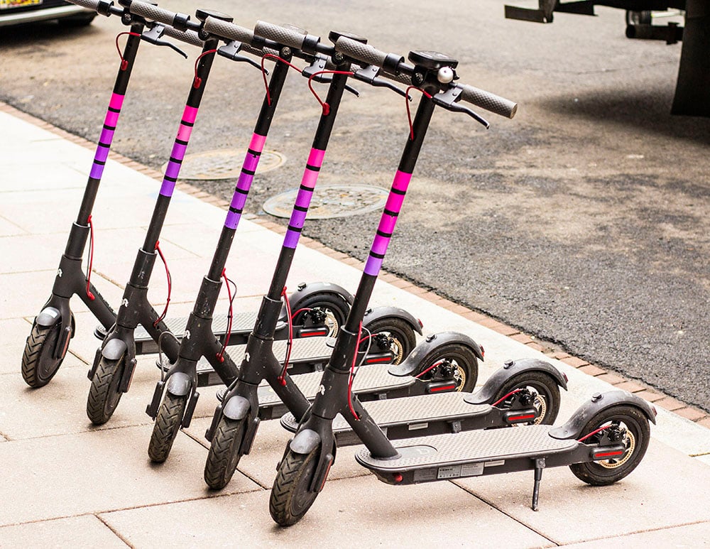
  • Try Traveling by Scooter

    Scooting is a convenient mobility option in the District. Follow these rules and safety tips to ensure a safe city for everyone.

  • On-Demand Shuttle Service

    DC Neighborhood Connect is an on-demand shared-ride shuttle service, offering service in parts of Wards 1, 4, 5 & 8 and the NoMa-Gallaudet Red Line Station in Ward 6.

COMMUTER BENEFITS

Many DC employers offer financial assistance, tools and incentives that save you money, time and stress on your commute. Commuter benefits include tax-free subsidies, corporate Capital Bikeshare memberships and telework arrangements. Ask your HR department which benefits are available to you.

Organizations with 20 or more employees in the District of Columbia are required to offer commuter benefits to their employees. This Law could help you save up to $1,000 a year on your commute costs.

  • Most commonly, employers allow you to set aside up to $315 per month on a pre-tax basis to cover commuting costs by public transit or vanpooling.
  • Many employers also choose to offer a tax-free subsidy for transit up to $315 per month.
  • Employees who participate in an employer-provided bicycle benefits program will have to report the benefit as taxable income.

Download this Justification Letter to communicate to your employer that setting up a commuter benefits program is mutually beneficial. You can also share our Employer Commuter Benefits Toolkit with your employer and encourage them to contact goDCgo’s Employer Services team—we’re happy to walk them through the setup process. Compliance with the law is mandatory. If your employer has 20+ employees but does not offer commuter benefits, contact the DC Department of Employment Services (DOES) Office of Wage-Hour at 202.671.1880 or OWH.ask@dc.gov.


Employers may offer a wide variety of benefits to make commuting easier, such as:

  • Tax-free subsidized transit benefits, up to $315/month, for use on Metro, buses, commuter rail and vanpools
  • Bicycle Commuter Benefit, for bike-related commute expenses
  • Free or discounted Capital Bikeshare memberships for employees’ use on commute and personal trips
  • Free or discounted car-sharing memberships for employee’s to access shared vehicles throughout the city

Employers may also provide innovative programs, including:

  • Telework, where employees work from home or another remote location
  • Flex/alternative work schedules, where work hours can be shifted so staff can beat rush hour or compressed to a 3 or 4 day workweek
  • Ride-matching assistance, where employers pair commuters with similar routes to form a carpool or vanpool
  • Parking cash-out, where employers give cash in lieu of a parking spot

Employers may offer on-site amenities, including:

  • Bike storage and lockers
  • Showers
  • Real-time transit displays

Savings on your commute will depend on the type of commuter benefits program offered by your employer. In general, employees who participate in a pre-tax commuter benefit can expect to save up to 40% per month. Contact your HR department for your programs’ specifics.

Enrolling in a commuter benefits program is usually fast and easy. Consult your organization’s HR department to learn about existing commuter benefits programs. If your workplace does not currently offer these benefits, use our template justification letter to communicate that setting up a program is mutually beneficial. You can also share our Employer Commuter Benefits Toolkit and let goDCgo’s Employer Services team walk your employer through the setup process.

TRANSPORTATION EQUITY INFORMATION

Washington, DC is heavily invested in providing affordable, alternative transportation options to residents across all eight wards of the city, regardless of income or ability. To help meet that goal, DC has a number of transportation programs that provide discounted access to Capital Bikeshare, the Metro, scooters, and more.

EXPLORE MORE TWO-WHEEL OPTIONS

Now that you’ve already been rolling on two wheels, try riding a scooter! Scooting has become a popular sustainable mobility option in the District. Follow these rules and safety tips to ensure a safe city for everyone.

TRANSPORTATION OPTIONS & RESOURCES

Bike

Finding a good route is important when you are trying to get around the region by bike. Fortunately, there are maps, apps, websites and tools to help you find your way. Listed below are some of our favorites. We are always looking for great apps and resources to add to our collection. Contact us with your suggestions.

State & District Maps

  • District of Columbia Bike Map PDF 24.9mb
  • Maryland Bike Map PDF 3.61mb
  • State of Virginia Bike Map PDF 8.57mb

City & County Maps

  • Arlington County, VA Bike Map PDF 7.55mb
  • City of Alexandria, VA Bike Map PDF 14.41mb
  • Fairfax County, VA Bike Map PDF 21.75mb
  • Montgomery County, MD Bike Map PDF 41.16mb
  • Prince George’s County, MD Bike Map PDF 4.02mb
  • City of Takoma Park, MD Bike Map PDF 2.4mb

To order a printed version, visit CommuterPage.com. For bulk copies, visit our brochure requests center.

Preview
  • Allows you to view all station locations and the number of available bikes and docks, purchase a pass, unlock a bike, and ride right away!

  • Citymapper

    Available on:   iOS Android

    The ultimate transport app that uses open data, mobile, and payment technology to make transport sustainable and hassle free; particularly useful for bike and dock availability.

  • CityMotion

    Available on:   iOS Android

    You’ll be able to get real-time information for all your mobility options anywhere and everywhere you go. Data is sorted by what’s most useful at the exact time and moment you open the app.

  • A robust, interactive transit map that shows metropolitan DC’s complete bike network. From bike-friendly roads to dirt paths and trails, this handy tool will help you get going on two wheels.

  • Helbiz

    Available on:   iOS Android

    Helbiz is your new urban mobility partner. Simply tap to instantly unlock, ride, and leave your e-bike anywhere for the next person to use.

  • Web tool identifying bike parking locations throughout the Washington, DC region.

  • Web tool helping you find safer bike routes.

  • Ride Report tracks your miles, maps your routes, and awards ride streaks for your daily errands and commutes.

  • Strava

    Available on:   iOS Android

    Social network connecting runners and cyclists through the sports they love.

  • Transit

    Available on:   iOS Android

    Transit is your real-time urban travel companion. Get accurate real-time predictions, simple trip planning, step-by-step navigation, service disruption notifications, and departure and stop reminders. You can also easily find and grab the closest bikeshare.

  • Map specializing in bike shops, trail access, incidents, and DC routes.

MORE BIKE INFO

Bus

The metro DC area offers a robust network of local and regional bus systems getting you to and around the city. Explore your options below to find a route that works best for you. We’re on the hunt for additional apps and resources to add to our collection. Contact us with your suggestions.


WASHINGTON, DC

  • District of Columbia Bus Map PDF 972.004kb
  • Late Night Bus Map PDF 6.86mb
  • DC Circulator Service Map PDF 4.13mb

VIRGINIA

  • Virginia Bus Map PDF 955.606kb
  • DASH King Street Trolley Map PDF 434.78kb
  • CUE Bus Service Map PDF 3.8mb

MARYLAND

  • Montgomery County Bus Map PDF 898.822kb
  • Prince George’s County Bus Map PDF 861.412kb
  • Takoma Langley Crossroads Transit Center Map PDF 4.1mb
  • YTS Annapolis Commuter Bus Map PDF 3.01mb
  • Ride On System Map PDF 9.15mb
  • TheBus System Map PDF 3.45mb

To order a printed version, visit CommuterPage.com. For bulk copies, email info@godcgo.com.

Preview
  • Actionfigure Mobile

    Available on:   iOS

    Get real-time trip planning and departure information, service alerts, and live crowding reports in the palm of your hand. Activate the app using the 5-digit code provided by your building or employer. (If you have an Actionfigure Screen in your lobby providing transportation information, you’ll find the code there.)

  • Citymapper

    Available on:   iOS Android

    The ultimate transport app that uses open data, mobile, and payment technology to make transport sustainable and hassle free.

  • Real-time Metrorail and Metrobus predictions for planning trips in DC, Maryland, or Virginia.

  • DC Metro Transit

    Available on:   Android

    Get real-time predictions for DC Metrorail, Metrobus, Arlington Transit (ART), DC Circulator, DC Streetcar, PG County-The Bus, Fairfax CUE, and UMD Shuttle. Keep track of your favorite stations and sort them however you like!

  • Transit

    Available on:   iOS Android

    Transit is your real-time urban travel companion. Get accurate real-time predictions, simple trip planning, step-by-step navigation, service disruption notifications, and departure and stop reminders.

  • TripGo

    Available on:   iOS Android

    Compare and combine any transportation mode like the bus, train, taxi, metro, a personal or shared car or bike, motorcycle, or rideshare.

  • Receive up to three itineraries for getting to your destination by bus, rail, or both. Available on WMATA’s website.

MORE BUS INFO

Rail

Whether you’re traveling by train, Metrorail or streetcar, the below maps, apps, websites and tools will help you find your way around the region by rail. Have an app or resource suggestion? Contact us with the details!

  • MARC Brunswick Line Map PDF 279.546kb
  • MARC Camden Line Map PDF 1.29mb
  • MARC Penn Line Map PDF 1.85mb
  • Metrorail System Map PDF 511.024kb
  • VRE System Map JPG 166.889kb
Preview
  • Actionfigure Mobile

    Available on:   iOS

    Get real-time trip planning and departure information, service alerts, and live crowding reports in the palm of your hand. Activate the app using the 5-digit code provided by your building or employer. (If you have an Actionfigure Screen in your lobby providing transportation information, you’ll find the code there.)

  • Amtrak

    Available on:   iOS Android

    Discover the convenience of traveling with Amtrak – The app provides simple and intuitive access to travel info

  • Citymapper

    Available on:   iOS Android

    The ultimate transport app that uses open data, mobile, and payment technology to make transport sustainable and hassle free.

  • Real-time Metrorail and Metrobus predictions for planning trips in DC, Maryland, or Virginia.

  • Get real-time predictions for DC Metrorail, Metrobus, Arlington Transit (ART), DC Circulator, DC Streetcar, PG County-The Bus, Fairfax CUE, and UMD Shuttle. Keep track of your favorite stations and sort them however you like!

  • Explore DC Streetcar’s 2.2-mile trolley line along H St NE. This interactive map shows real-time data.

  • An official WMATA tool, Next Arrivals shows real-time arrival information for both Metrorail and Metrobus.

  • Transit

    Available on:   iOS Android

    Transit is your real-time urban travel companion. Get accurate real-time predictions, simple trip planning, step-by-step navigation, service disruption notifications, and departure and stop reminders.

  • TripGo

    Available on:   iOS Android

    Compare and combine any transportation mode like the bus, train, taxi, metro, a personal or shared car or bike, motorcycle, or rideshare.

  • VRE Mobile

    Available on:   iOS Android

    Buy and use tickets and passes for VRE Commuter Rail.

  • VRE Rider

    Available on:   iOS

    Browse the train schedules, see where stations are located, and get fare information. You can also get alerts from VRE and Twitter, and current train locations.

  • Receive up to three itineraries for getting to your destination by bus, rail, or both. Available on WMATA’s website.

MORE RAIL INFO

Car

Today, travelling by car doesn’t need to mean travelling alone. Share the ride, hail a cab or borrow a vehicle using the apps and tools below. See something missing? Let us know!

  • DC Parking Zones Map PNG 582.031kb
  • Map of District HOV Lanes JPG 337.145kb
Preview
  • eRideShare

    Available on:   Android iOS

    A free service for connecting commuters, cross country travelers and people running quick errands.

  • Plan your trip ahead of time with goDCgo’s Transit Map – find parking lots near area transit.

  • Lyft

    Available on:   Android iOS

    Share the ride with others going the same way, and pay up to 60% less via Lyft Line. Or, rent a car of your own from designated Lyft Rentals locations.

  • Free2Move

    Available on:   iOS Android

    Free2Move is DC’s newest and one of the largest carsharing fleets. You can locate and book a car directly through the app, to get you where you want to go.

  • parkDC

    Available on:   Android iOS

    Easily find on- and off-street parking in DC. Use filters to search for parking spaces by price per hour and/or time period.

  • Quickly find and reserve parking in DC, particularly convenient when going to events or visiting.

  • Parkmobile

    Available on:   Android iOS

    Pay for metered parking with the tap of a finger — get parking session expiration warnings and more.

  • Sluglines

    Available on:   Android iOS

    Discover slugging locations near you and request a slug pick-up. Enjoy a forum where users discuss all things slugging.

  • Sameride

    Available on:   iOS Android

    On-demand carpool for fast and low-cost commutes.

  • VIA

    Available on:   Android iOS

    Ride 24 hours a day, 7 days a week anywhere in Washington, DC. Ride from just $2.95.

  • uberPOOL

    Available on:   Android iOS

    Share your ride and split the cost of your trip with another Uber rider headed in the same direction.

  • Carpooling connection service for commuters traveling to or living in Washington, DC.

MORE CAR INFO

Walk

Did you know DC is the 7th most walkable city in the nation? Take advantage of the region’s pedestrian network by tapping into the below websites, maps and tools. Have something to add? Reach out with your suggestions.

  • Metrorail Walking Map PNG 1.89mb
  • Pedestrian Network Map PDF 10.09mb
  • National Mall Walking Tour PDF 1.59mb
Preview
  • A robust, interactive transit map that shows metropolitan DC’s complete network of paths, trails and more

  • Walk Score

    Available on:   iOS Android

    Walk Score rates neighborhoods based on the ease of walking to shops, restaurants and other…

  • The Pocket Guide to Transportation is a compilation of statistics that provides key info for the U.S. transportation system…

  • Find fitness at your own pace – Plan, track, study and share your journey with Under Armour’s MapMyWalk

MORE WALK INFO

EXPLORE A NEW COMMUTE

Looking to change up your commute? Our map has all of the information you need to plan out a new route.

GET TO KNOW YOUR OPTION

EVENTS

SIGN UP FOR THE LATEST

Subscribe to the goDCgo Newsletter to receive helpful tips and ideas to make your daily travel easier than ever


CARPOOL

Thinking about carpooling but not sure where to start? You’re in luck! With a rideshare database and guaranteed ride home, Commuter Connections can help make carpooling easy. 

Recent Blogs

YOU Can Make a Difference!

Use goDCgo’s quick reference guide of transportation options in Washington, DC so you can travel sustainably.